The Benefits of Using Drones for Roof Inspections
Roof inspection is dangerous and time consuming work. And maintaining accuracy and consistency within a set of rooftop
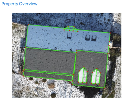
measurements can be challenging. Manual measurement is inefficient and often results in errors or missed information, requiring teams to follow up with a secondary inspection. With drones, you no longer have to worry about inaccurate data or having to return to a site to gather missed information. Unlike other solutions, the data you’re working with is up-to-date, so you’re not dealing with imagery that is weeks or months old. With high-resolution drone maps and models, roof inspection and measurement becomes
safer, streamlined, and more accurate. Here are some of the benefits of leveraging a drone solution in the solar, insurance, and roofing sectors:
High-Resolution Maps and 3D Models in Minutes
Unlike traditional methods, drones take minutes to collect roof data. Once you get back to the office, process and export your data for further analysis.
Accurate and Consistent Measurements
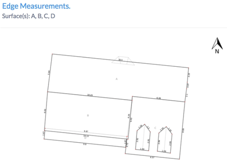
Our roofing solution uses computer vision and machine learning algorithms to generate automated measurements that are 99% accurate. This eliminates the potential for measurement error, and makes it possible to measure square footage, roof features, pitch, surface area, and slope consistently across every site.
Visual Inspection from the Safety of the Ground
Your team no longer has to scale a ladder or walk out on a ledge to complete a visual inspection. With drones, we can safely inspect dangerous or inaccessible areas. Pinpoint issues—such as cracks, leaks, and damage—with high-resolution orthomosaic
maps, and eliminate the need to climb a roof unless it requires repair.


